What Is Geofencing in Construction Safety?
Geofencing is a location-based technology that creates invisible, virtual boundaries around specific areas – and it’s changing the way construction sites manage safety. Think of it like drawing a digital fence around a job site, a crane swing radius, an excavation pit, or any other area where people and equipment interact. When someone or something crosses that boundary, the system knows about it immediately. These virtual perimeters can be as large as an entire project site or as small as a 10-foot radius around a piece of heavy equipment. In construction, where the stakes are incredibly high, this kind of precision monitoring can mean the difference between a close call and a catastrophic incident. 🚧
The technology behind geofencing draws on several tools working together. GPS satellites provide broad positioning data, while cellular networks, Bluetooth beacons, and RFID tags help fill in the gaps – especially in areas where satellite signals are weak. Workers might wear smart badges, GPS-enabled hard hats, or wrist-worn devices that broadcast their location continuously. Vehicles and heavy equipment are fitted with telematics units that do the same. All of this location data feeds into site-management software that monitors movement in real time, compares positions against the virtual boundaries you’ve set, and fires off alerts or automated responses the moment a trigger condition is met. It’s a connected ecosystem designed to keep everyone safer.
Why Construction Sites Need Digital Guardrails
Construction sites are some of the most dynamic and unpredictable work environments on the planet. 🏗️ Every day, the layout changes – new trenches open up, equipment moves to different areas, temporary scaffolding goes up, and fresh hazards appear without much warning. Add in multiple subcontractors who may not be familiar with the day’s updated site conditions, limited sightlines caused by stored materials and structures, and the constant noise that makes verbal warnings unreliable, and you’ve got a recipe for serious accidents. Physical signs and painted lines on the ground simply can’t keep pace with how quickly conditions evolve. By the time a warning sign is posted, the hazard may have already moved or changed shape entirely.
This is exactly where digital guardrails fill a critical gap. Geofencing addresses some of the most persistent and deadly risks on construction sites – unauthorized access by members of the public or unqualified workers, collisions between pedestrians and moving vehicles, trucks or machinery wandering outside approved routes, workers entering energized or restricted zones without proper authorization, and slow emergency response when no one is sure where people are located. Instead of relying solely on human observation, which is naturally limited by fatigue, distraction, and blind spots, geofencing creates an always-on monitoring layer that reacts instantly. That constant vigilance is something no amount of signage or safety tape can replicate.
How Automated Geofencing Works on a Job Site
Setting up a geofencing system starts with mapping. Using a current site plan, safety managers draw virtual boundaries around the areas they want to monitor – whether that’s the entire perimeter, a crane exclusion zone, or a pedestrian walkway running alongside an active haul road. Once those boundaries are defined in the software, the next step is assigning people and assets to the system. Workers are paired with tracking devices, vehicles are fitted with telematics units, and each asset is given a profile that includes what zones it’s allowed to enter and under what conditions. From there, the team defines trigger conditions – the specific events that should cause the system to respond – and selects what that response will be.
Common triggers are straightforward but powerful. A worker’s badge signal crossing into a marked danger zone triggers one type of response. A delivery truck crossing the site perimeter outside of approved hours triggers another. Equipment approaching a designated pedestrian corridor, or an unregistered device entering a restricted area, can each set off their own chain of events. The beauty of a well-configured system is that it doesn’t wait for a human to notice something is wrong – it detects the condition automatically and responds within seconds. This speed is what gives geofencing its real safety value on a busy job site where things happen fast.
Once a trigger fires, the system has a range of possible responses available. On the lighter end, it might send a push notification to a worker’s smartphone or cause a wearable device to vibrate, alerting them that they’re approaching a restricted area. More serious triggers might set off audible alarms on equipment or at a site entrance. Supervisors and safety managers can receive simultaneous notifications on their devices, with the event automatically logged for recordkeeping. In more advanced configurations, access-control systems can lock gates, and equipment telematics can be programmed to slow or stop machinery when a proximity alert is triggered. The right combination of responses depends on the hazard level and how well the system has been tested. ⚠️
GPS, Wearables, and Equipment Telematics
The location data that makes all of this possible comes from several sources working in parallel. Worker badges and smart helmets equipped with GPS or Bluetooth chips broadcast each person’s position continuously throughout the shift. Smartphones running site-management apps can do the same when a dedicated wearable isn’t available. On the equipment side, telematics units installed in trucks, excavators, forklifts, and cranes track machine position, speed, and operational status in real time. Proximity sensors mounted on equipment can detect nearby workers even when GPS accuracy isn’t perfect, adding a close-range layer of detection. Together, these technologies give safety managers a live picture of where every person and machine is on the site at any given moment – and that picture is what powers every automated safety decision.
Real-Time Alerts Versus Automated Controls
There’s an important distinction between a system that warns and a system that acts. Real-time alert systems send notifications to workers, spotters, or supervisors when a boundary condition is triggered, but they rely on a human to take action in response. Automated control systems go a step further – they can physically slow, stop, lock out, or restrict equipment without waiting for human input. Both approaches have their place, but automated controls carry higher stakes. If a system is configured to shut down a crane automatically when a worker enters a radius, that action needs to have been thoroughly tested under real site conditions to avoid creating new hazards – like a sudden stop that causes a load to swing. The more consequential the automated action, the more rigorous the validation process needs to be before it goes live. 🔧
High-Value Geofencing Use Cases for Construction Safety
One of the most straightforward applications of geofencing is protecting the site perimeter. A virtual boundary around the entire project site can alert security and supervisors the moment someone enters outside of authorized hours – whether that’s a curious member of the public, a potential thief, or a worker who wasn’t supposed to be on site that day. This kind of after-hours monitoring helps protect stored materials and expensive equipment from theft and vandalism, while also keeping unauthorized individuals away from hazards that exist even when active work isn’t happening. During working hours, the same perimeter fence can track subcontractor arrivals and departures, supporting both safety and workforce management goals.
Beyond the perimeter, exclusion zones are where geofencing really earns its keep. Areas around operating cranes, open excavations, demolition zones, energized electrical systems, active roadways, and heavy-equipment haul routes are among the most dangerous spaces on any job site. Establishing a geofenced exclusion zone around these areas means that any unauthorized entry – whether by a worker who didn’t get the memo or a vehicle that drifted off course – triggers an immediate alert. These zones can be sized to match the specific hazard, with larger buffers around crane swing areas and tighter boundaries around equipment staging zones. The result is a dynamic safety net that works even when a spotter’s attention is momentarily divided.
“For example, geofencing can be adopted within the construction industry to identify and establish virtual barriers around high-risk or high-traffic areas.” -National Safety Council
Vehicle-to-worker proximity alerts represent another high-value use case that directly addresses one of construction’s deadliest hazard categories. When a dump truck, forklift, loader, or crane approaches a zone where workers are on foot, the system can alert both the equipment operator and the worker simultaneously. This is especially valuable in areas with poor sightlines, high noise levels, or complex traffic patterns where a driver might not see a worker until it’s too late. Pedestrian-only zones can be geofenced so that any vehicle intrusion triggers an immediate response – stopping the vehicle, alerting the operator, and notifying a supervisor – all within seconds of the boundary being crossed. 🚜👷
Restricted and High-Risk Zone Enforcement
One of the most practical advantages of digital geofences over physical barriers is how easily they can be updated. As a construction project moves through its phases, the locations of hazards shift constantly – an area that was safe last week may be directly above an active excavation today. With a geofencing platform, supervisors can log in, redraw a boundary, change its trigger conditions, and push the update to all connected devices in minutes. This flexibility means that digital guardrails can keep pace with the site in a way that physical cones and tape simply cannot. Activating a new exclusion zone before a demolition sequence begins, or deactivating one after an excavation is backfilled, is a matter of a few clicks rather than a physical crew moving barriers around the site.
Work-Zone and Public-Roadway Protection
Construction activity near public roadways creates a unique set of hazards – not just for workers, but for the drivers passing through. Geofenced work zones can be configured to send real-time alerts to workers when a vehicle enters the protected area, giving them precious extra seconds to move to a safe position. Some systems integrate with connected vehicle platforms or highway advisory systems to notify approaching drivers of active construction zones, lane closures, or reduced speed limits ahead. For roadway construction crews who work in some of the most exposure-heavy environments in the industry, this kind of early warning system can be a genuine lifesaver. 🚦
Using Geofencing to Reduce Struck-By and Caught-In Hazards
Struck-by incidents are the leading cause of construction fatalities, and geofencing is one of the most direct tools available for reducing them. The fundamental problem with struck-by hazards is that they often happen faster than a person can react – a vehicle backs up, a load swings, a piece of material falls, and there’s no time for a visual warning to make a difference. Geofencing extends the warning window by detecting dangerous proximity before the hazard is visible. When a worker enters a reversing zone or a vehicle approaches a pedestrian area, the alert fires based on location data – not on whether a human observer happened to be looking in the right direction at the right moment. That earlier warning is what gives workers and operators the time they need to respond safely.
[cta-call:Call2]
Caught-in and caught-between hazards deserve equal attention in any geofencing strategy. These incidents involve workers being trapped, compressed, or pulled into machinery, moving materials, or structural elements – and they’re often just as deadly as struck-by events. Geofencing can help by establishing tight exclusion zones around machinery with moving parts, marking the edges of excavations where a worker could fall and become trapped, identifying the crushing zones around equipment during lifting operations, and flagging vehicle blind spots where a worker might be invisible to an operator. By combining location tracking with proximity sensors on equipment, the system can detect when a worker is dangerously close to a caught-in hazard and respond before contact occurs. ⛏️
Designing a Construction Site Geofence Map
A geofence map is only as good as the site plan it’s built on. The process should start with a thorough review of the current site layout – one that clearly identifies all entrances and exits, approved equipment routes and haul roads, pedestrian walkways, emergency access paths, material storage areas, utility locations, and the specific high-risk operations planned for each phase of the project. This isn’t a one-time exercise. The map needs to be a living document that reflects real conditions on the ground, updated as the project evolves. Starting with a detailed, accurate foundation makes it much easier to draw boundaries that actually protect people rather than just looking good on a screen.
“One in four ‘struck by vehicle’ deaths involve construction workers, more than any other occupation.” -Occupational Safety and Health Administration
Not all geofences are created equal, and understanding the different types helps safety managers build a more effective system. Permanent geofences stay in place for the duration of the project – things like the site perimeter or a main entrance gate. Temporary geofences are set up for specific operations and removed when the work is done, like a zone around a concrete pour or a crane lift. Dynamic geofences can shift automatically based on equipment position or time of day. Layered geofences use multiple concentric boundaries around a single hazard, with each layer triggering a different level of response – an outer warning zone, a middle restricted zone, and an inner emergency exclusion zone closest to the hazard itself. Using these types thoughtfully creates a graduated system that gives workers multiple chances to correct course before they reach the most dangerous area.
Technical accuracy matters just as much as boundary placement. GPS technology has inherent drift – small errors in position reporting that can place a worker’s icon a few feet away from their actual location. On a large open site, a few feet might not matter much. But near the edge of an excavation or within the swing radius of a crane, those few feet are the difference between safe and dangerous. Boundary tolerances should account for known GPS inaccuracy by setting alert triggers slightly before the actual hazard boundary, giving workers reaction time even if the location data isn’t perfectly precise. Signal performance should be tested throughout the site before going live, with particular attention to areas near large metal structures, underground spaces, or dense building interiors where signals can be blocked or reflected. 📡
Mapping Warning, Restricted, and Emergency Zones
The most effective geofence designs use multiple boundary layers with escalating responses rather than a single all-or-nothing alert. An outer warning zone might send a gentle vibration to a worker’s wearable and log the event – a heads-up that they’re approaching a sensitive area. The middle restricted zone triggers a more assertive alert to both the worker and their immediate supervisor, prompting a check-in. The innermost emergency zone activates the strongest available response – an audible alarm, an equipment slowdown, and an immediate notification to the site safety manager. This graduated approach gives workers and supervisors proportional information based on the severity of the situation, rather than treating every boundary crossing as a five-alarm emergency.
Updating Geofences During Project Phases
Geofence maps need to be reviewed far more often than most safety managers initially expect. Daily planning meetings are a natural checkpoint – if the day’s work includes a new excavation, a crane pick, or a concrete delivery, the boundaries should be reviewed and adjusted before the crew starts. Shift changes are another critical review point, especially when night crews are working in different areas than the day shift. Weather events that affect ground conditions, emergency deliveries, demolition sequences, and any major change to the site layout should all trigger a map review. Assigning a specific person – ideally the site safety manager – ownership of the geofence map ensures that updates actually happen rather than falling through the cracks of a busy project schedule. 🗺️
Connecting Geofencing With Construction Safety Systems
Geofencing becomes significantly more powerful when it’s connected to the other safety and management systems already running on a job site. Integration with safety-management platforms allows location events to feed directly into incident reporting workflows. Digital permit systems can check whether a worker is actually in the area covered by their permit before allowing work to begin. Access-control systems can use geofence data to automatically log who entered restricted areas and when. Equipment telematics platforms can combine location data with machine diagnostics to flag situations where equipment is operating outside approved areas or in unsafe conditions. Cameras tied to geofence triggers can automatically begin recording when a boundary is crossed, capturing visual evidence of the event. Even emergency communication systems benefit, giving first responders accurate location data for everyone on site the moment an incident is reported.
Beyond real-time safety, the data generated by a geofencing system creates an invaluable audit trail. Every boundary crossing, every alert, every response is timestamped and stored – creating a detailed record of site activity that can support incident investigations, verify that workers received safety briefings before entering restricted areas, and document compliance with permit conditions. Over time, this data reveals patterns that aren’t visible in the moment – a particular zone that generates repeated proximity alerts, a vehicle route that keeps drifting toward a pedestrian area, or a time of day when unauthorized entries spike. Those patterns are gold for a safety team trying to identify and eliminate recurring exposures before they result in an injury. 📊
“The Wearables alerted workers on three occasions when they unintentionally exited safe working limits.” -Tended and Siemens
Building Automated Alert and Response Rules
Defining alert rules is where the technical setup meets practical safety management. For each trigger condition, the team needs to decide who receives the alert, through what channel – app notification, SMS, radio call, wearable vibration – and how it’s prioritized relative to other alerts that might be firing at the same time. Equally important is defining what workers and supervisors are expected to do after receiving a warning. An alert that goes out but has no defined response protocol is just noise. Clear, pre-communicated procedures – stop work, move to a safe area, contact the supervisor, confirm the situation is resolved – turn alerts into actionable safety interventions rather than digital background chatter.
Alert escalation is a critical design element that’s often overlooked in early implementations. If a worker receives an alert and doesn’t acknowledge it within a set timeframe, the system should automatically escalate – notifying the foreman, then the site safety manager, then the project manager if needed. For events that involve immediate life-safety risk, escalation to emergency response personnel should happen quickly and automatically. The escalation chain should be documented, tested, and communicated to everyone in it before the system goes live. Nobody should be surprised to receive an escalated alert during an actual emergency – they should already know what it means and what they’re expected to do. 📱
Alert fatigue is a real and serious risk in any monitoring system. When workers and supervisors receive too many alerts – especially ones that turn out to be false alarms or low-priority informational events – they start tuning them out. That’s the opposite of what a safety system should accomplish. Avoiding alert fatigue requires thoughtful threshold design. Not every boundary crossing warrants the same response. Informational events, like a supervisor walking through a monitoring zone during a routine inspection, should be logged quietly rather than triggering a full alert. High-risk events should trigger immediate, unmistakable responses. The team should regularly review false alarm rates and adjust boundary sizes, trigger conditions, and response levels based on what the data shows. A system that cries wolf eventually gets ignored. 🐺
Examples of Geofencing Rules
Concrete examples make alert rules much easier to design and communicate. A reversing zone behind a dump truck might be configured so that any worker entering the zone automatically notifies the assigned spotter via radio and causes the truck’s backup alarm to increase in volume. A site haul road might have a boundary that alerts the dispatcher and the truck driver’s supervisor if the vehicle deviates more than 20 feet from the approved route. A critical lift area might be configured so that any pedestrian entering the crane’s load path automatically triggers a pause signal to the crane operator’s cab display and sends a notification to the lift director – giving them the information they need to make a safe decision without taking the decision entirely out of human hands. These specific, scenario-based rules are far more effective than vague, generic alert configurations.
When to Use Human Confirmation
Fully automated responses – where a system takes a physical action without any human in the loop – should be reserved for situations where the risk is well-defined, the system has been extensively validated, and the automated action itself cannot create a new hazard. For most high-consequence situations, building in a human confirmation step is the safer approach. If a geofence trigger is going to result in equipment being locked out or a gate being closed, a supervisor or safety officer should confirm the situation before that action is taken, unless the system has been tested and certified to act reliably under the specific conditions present on that site. Human judgment remains an essential safeguard, especially in the complex, variable environments that construction sites represent every single day. 🧠
Worker Privacy, Data Governance, and Compliance
Tracking worker locations raises legitimate privacy concerns that employers need to address directly and transparently. The data collected by a geofencing system – where workers are, when they arrived, how long they spent in various areas, and when they left – is sensitive information. Employers should be clear about exactly what data is collected, how long it is retained, who within the organization can access it, and what it will and won’t be used for. There’s an important difference between monitoring worker locations for safety purposes – to protect them from hazards – and using that same data to micromanage productivity or create disciplinary records. Workers have a right to understand which of those purposes applies to them, and employers have a responsibility to make sure the answer is the right one.
“Vehicles and equipment operating in and around the work zone are involved in over half of the worker fatalities in the construction industry.” -Occupational Safety and Health Administration
Building a solid data governance framework before launching a geofencing program is not optional – it’s essential. This means drafting a written policy that explains the program’s purpose, scope, and limitations, and sharing it with workers before the system goes live. Access to location data should be restricted to personnel with a legitimate safety need, not made available to the entire management team. Data should be stored securely, with a defined retention period after which it is deleted. Vendor contracts should specify how the technology provider handles, stores, and protects the data they process on your behalf. And given the evolving legal landscape around employee monitoring in many jurisdictions, consulting with legal counsel and labor relations specialists before rollout is strongly recommended. Getting this right from the start protects workers and the organization. 🔒
Limitations and Risks of Geofencing Technology
Geofencing is a powerful tool, but it’s not a perfect one. GPS signals can drift, placing a worker’s icon several feet from their actual position. Indoor environments, underground spaces, tunnels, and areas surrounded by large steel structures can block or reflect signals entirely, creating dead zones where the system can’t reliably track location. Battery failure in a wearable device, a damaged tracker, a dropped connection to the cellular network, or a software glitch can all cause the system to lose track of a worker or a vehicle without anyone realizing it. Inaccurate site maps that haven’t been updated to reflect current conditions can place boundaries in the wrong locations. And delayed alerts – even a few seconds late in a fast-moving situation – can reduce the system’s protective value significantly. These aren’t reasons to avoid geofencing; they’re reasons to implement it with clear eyes and realistic expectations. ⚡
It’s worth saying plainly: geofencing is a supplement to good safety practice, not a replacement for it. A geofence does not eliminate the need for a thorough hazard assessment before work begins. It does not replace physical barriers, lockout/tagout procedures, trained spotters, safety signage, or personal protective equipment. It does not substitute for competent supervision or a well-trained workforce. The strongest safety programs layer digital tools on top of a solid foundation of physical controls and human expertise – not instead of them. Workers who understand that the geofencing system is one layer of protection among many are better prepared to maintain their own situational awareness rather than assuming the technology will always catch every hazard.
Perhaps the most dangerous failure mode of a geofencing system isn’t a technical one – it’s a behavioral one. When workers and supervisors start to believe that the system will always warn them before something goes wrong, they may unconsciously reduce their own vigilance. This overreliance on digital alerts is a genuine risk that needs to be addressed head-on in training. Every implementation plan should include explicit fallback procedures for when the system fails – what workers should do if their device loses signal, what supervisors should do if the platform goes offline, and how the site will manage safety during a connectivity outage. A safety system that doesn’t have a plan for its own failure is not a complete safety system. 🛑
Implementation Plan for a Geofencing Safety Program
A successful geofencing program doesn’t appear overnight – it’s built in phases. The process should start with a formal hazard assessment that identifies the highest-risk areas and interactions on the site, because those are where the technology will deliver the most value. From there, the team selects technology platforms and devices that match the site’s needs, drafts the initial geofence map, completes a privacy and data governance review, and identifies a pilot area for initial testing. Worker training happens before any devices are distributed, and the system is performance-tested in the pilot area before expanding. This phased approach surfaces problems while they’re still small and manageable, rather than discovering them after the system is running across an entire large-scale project.
Choosing the right technology requires matching the tools to the environment. A large open-air infrastructure project has very different needs than a dense urban high-rise. Key selection criteria include the accuracy and reliability of the positioning technology in your specific site conditions, battery life of wearable devices across a full shift, connectivity requirements and available network coverage on site, compatibility with telematics systems already installed on your equipment, cybersecurity features of the software platform, and the vendor’s track record with similar projects. Scalability matters too – a system that works well for a 50-person crew should be able to grow with the project without requiring a complete rebuild. And vendor support quality is often the difference between a system that gets used and one that gets abandoned after the first round of technical problems. 💻
“The technology has also shown promise as an effective risk mitigation tool, alerting ground…” -National Safety Council
Measuring the program’s effectiveness requires defining success metrics before the system goes live. The most direct indicators include the number of unauthorized zone entries detected, the frequency of vehicle-pedestrian proximity events, response times from alert to resolution, rates of false alarms, and the number of near misses reported. Over time, trends in these numbers tell a clear story about whether the system is working as intended or whether boundaries, alert rules, or training need to be adjusted. Worker feedback is an equally important data source – the people wearing the devices and responding to the alerts every day have insights about what’s working and what isn’t that no dashboard can provide on its own. Regular review of all of this information keeps the program improving rather than stagnating.
Training Workers and Supervisors
Effective training goes well beyond showing workers how to put on a device and turn it on. Every person on site who interacts with the geofencing system needs to understand where the boundaries are located and why they exist, how to interpret the alerts they receive and what action each one requires, how to check and charge their device before each shift, how to report a device malfunction or signal loss, and what the emergency procedures are if the system goes down. Critically, training should reinforce that digital alerts are a safety aid – not a replacement for paying attention. A worker who walks toward a hazard thinking “the system will warn me if I get too close” is a worker who is less safe than one who maintains active situational awareness at all times. 👷♂️
Testing Before Full Deployment
Before activating the system across the entire project, a controlled testing phase is essential. Testing should involve representative vehicles and devices – not just the newest equipment in the best condition, but the older trucks and worn wearables that will actually be used on site. Tests should be run under different signal conditions, including areas near metal structures and in any enclosed spaces on the site. Scenarios should cover different shift patterns, since signal behavior can vary between day and night. Emergency scenarios should be simulated to verify that escalation chains work correctly and that all relevant personnel receive the right notifications in the right order. Document everything that doesn’t work as expected during testing, fix it, and test again before going live. 🔍
Measuring Return on Safety Investment
The most direct evidence that a geofencing program is working shows up in the incident and near-miss data. Fewer unauthorized entries into restricted zones, a downward trend in vehicle-pedestrian proximity events, faster average response times from alert to resolution, and a reduction in reported near misses all indicate that the digital guardrails are doing their job. Improved documentation is another direct benefit – every event is automatically logged with a timestamp, location, and device ID, creating records that support investigations, demonstrate due diligence, and help identify patterns that need to be addressed. Over time, these records build a picture of site safety performance that is far more detailed and reliable than manual observation alone could produce.
Beyond the direct safety metrics, geofencing programs tend to generate broader operational benefits that contribute to the overall return on investment. Safety inspections become more efficient when managers can see real-time location data rather than physically walking the site to verify compliance. Equipment accountability improves when telematics data shows exactly where machines have been and whether they stayed within approved operating areas. Work-zone communication gets better when all parties – workers, operators, supervisors, and sometimes the public – are receiving consistent, timely information about site conditions. And coordination among multiple subcontractors improves when everyone is working within the same digital framework, with shared visibility into who is where and what hazards are active at any given moment. The safety and the efficiency benefits reinforce each other in a well-run program. 📈
Best Practices for Reliable Digital Guardrails
The most effective geofencing programs don’t rely on technology alone. They combine digital guardrails with the physical and procedural controls that have always been the foundation of good construction safety. This means maintaining physical separation between pedestrians and equipment wherever possible, using visible signage that reinforces the digital boundaries workers can’t see with their eyes, developing and following traffic-control plans that define approved vehicle routes, conducting pretask planning meetings that address the specific hazards of the day’s work, and following equipment-specific operating procedures that don’t get set aside just because a geofencing system is running in the background. Digital tools amplify good safety practices – they don’t compensate for the absence of them. 🏆
Sustained performance requires clear ownership. Someone needs to be responsible for keeping the geofence map current, maintaining and replacing devices as needed, monitoring alert response patterns, reviewing incident data, and conducting periodic audits of the entire system. When ownership is unclear, maps go stale, devices go uncharged, and the system gradually becomes less reliable without anyone noticing until something goes wrong. Assigning specific roles and responsibilities – and holding people accountable for them – is just as important as selecting the right technology. A world-class geofencing platform managed by no one in particular will underperform a modest system managed by a dedicated, attentive safety team every single time.
Finally, the best geofencing programs treat every event as a learning opportunity. When a proximity alert fires, the question shouldn’t just be “did the worker respond correctly?” – it should also be “why was the worker in that position in the first place, and what can we change to prevent it from happening again?” Reviewing event data with workers, adjusting boundary sizes based on real-world performance, updating response rules when escalation chains aren’t working as intended, and documenting lessons learned after every incident and near miss all contribute to a program that gets better over time. Continuous improvement isn’t a nice-to-have – it’s what separates a geofencing program that actually protects people from one that just generates data. 🔄
FAQ: Digital Guardrails and Geofencing for Construction Safety
What is geofencing in construction?
Geofencing in construction is a digital boundary system that uses location data – from GPS, Bluetooth, RFID, or cellular networks – to monitor the positions of workers, vehicles, and equipment in real time. When a person or asset enters or leaves a designated area, the system detects the crossing and triggers a predefined response, which might be an alert to the worker, a notification to a supervisor, an entry in the safety log, or in some configurations, an automated action like slowing equipment or locking access. It’s essentially a virtual fence that watches the site continuously, without the limitations of human observation.
Can geofencing prevent construction-site accidents?
Geofencing can meaningfully reduce the risk of certain types of accidents by detecting dangerous conditions earlier and providing warnings faster than visual observation alone. However, it cannot guarantee accident prevention. Technology fails, signals are lost, alerts are missed, and human behavior doesn’t always follow the expected pattern. Geofencing works best as one layer in a comprehensive safety program that also includes physical barriers, thorough hazard assessments, lockout/tagout procedures, trained spotters, regular safety training, and competent supervision. Treating it as a complete solution on its own is a mistake that could create a false sense of security. ⚠️
How accurate is construction-site geofencing?
Accuracy varies considerably depending on the technology used, the quality of the devices, the site environment, and how the boundaries are configured. Standard GPS accuracy is typically within a few meters under open-sky conditions, but that can degrade significantly near large structures, in urban canyons, underground, or indoors. Bluetooth and RFID-based systems can provide much tighter accuracy in specific areas but require infrastructure to be installed on site. Before relying on a geofencing system for safety-critical decisions, teams should conduct thorough testing across the site to measure actual accuracy, identify dead zones, and set boundary tolerances that account for the worst-case positioning error they observe. 📡
What hazards can geofencing help control?
Geofencing is particularly well-suited to managing hazards that involve people and equipment sharing space. Common applications include struck-by prevention for vehicle-pedestrian interactions, unauthorized entry into restricted zones, exclusion zone enforcement around cranes and excavations, demolition and energized-system safety, equipment theft and after-hours intrusion, proximity alerts near machinery with caught-in hazards, and roadway work-zone protection for crews working near live traffic. Essentially, any situation where knowing that a person or machine has crossed a specific boundary would allow a faster, better safety response is a candidate for geofencing. 🚧
Does geofencing monitor workers’ locations all the time?
That depends entirely on how the system is configured and what the employer’s policy specifies. Some systems track location continuously throughout the shift, while others only log position data when a boundary event occurs. The right answer for any organization depends on the safety objectives, the privacy expectations of the workforce, and applicable legal requirements in the jurisdiction. What’s non-negotiable is transparency – workers should know before they set foot on site that location tracking is in use, what data is being collected, how it will be used, who can access it, and how long it will be retained. Clear policies, written notice, and restricted data access are the minimum standards for any responsible geofencing program. 🔒
Conclusion: Turning Construction Site Boundaries Into Active Safety Controls
Geofencing represents a genuine leap forward in construction site safety – not because it replaces the fundamentals, but because it makes them smarter and faster. Virtual boundaries that adapt as the project evolves, real-time alerts that reach workers and supervisors before a hazard becomes an incident, automated responses that don’t wait for a human to notice something is wrong, and detailed event logs that reveal patterns invisible to the naked eye – these are capabilities that physical guardrails and safety tape simply cannot provide. The strongest programs layer these digital tools on top of a solid foundation of physical controls, competent supervision, thorough worker training, and site plans that are updated as conditions change. When all of those elements work together, the result is a safety system that is genuinely greater than the sum of its parts. 🏗️✅
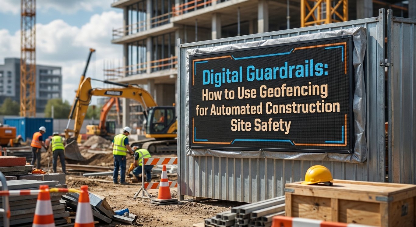
If you’re considering a geofencing program for your project, the best place to start is small and specific. Identify the highest-risk area on your current site – the zone where a vehicle-pedestrian interaction, an unauthorized entry, or an equipment proximity event is most likely to cause serious harm – and build your pilot there. Test the system thoroughly, measure its accuracy, gather worker feedback, and evaluate how the alert and response rules perform under real conditions before expanding. Use the principles in this guide – Digital Guardrails: How to Use Geofencing for Automated Construction Site Safety – to structure your hazard mapping, design your alert rules, plan your system integrations, build your privacy framework, and drive continuous improvement across every phase of the project. The technology is ready. The question is whether your program is built to use it well. 🚀
Ready to take the next step? Start by reviewing your current site’s highest-risk zones and consulting with a geofencing technology provider experienced in construction environments. A focused pilot program, designed with clear safety goals and strong worker communication, is the most reliable path to building digital guardrails that actually protect the people on your site every single day.